Test Map
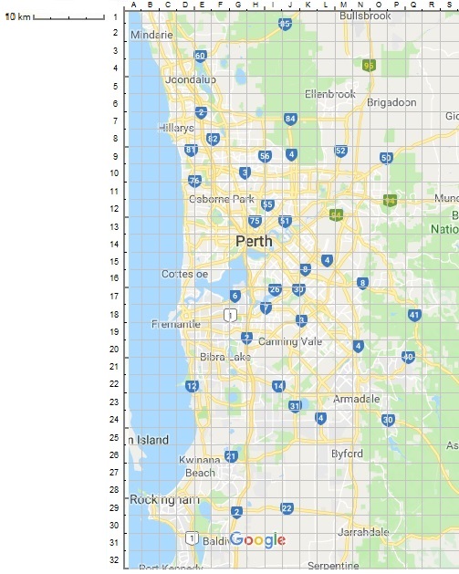
Use the coordinates on this map as addresses in the testing version of the booking screen. Coordinates are derived by getting a longitude value from the top of the map (A-S) and combining it with a latitude value from down the left hand side (1-32). For example enter an address of D18 for Central Fremantle, or H14 for Perth CBD. Each grid represents a 2.5km square. For realism, it is best to use reasonable values that correspond to typical booking locations, however the system will accept coordinates for ocean, river or other uninhabited areas. Distances will be measured based on a simple North-South East-West travel pattern. For example the travel distance between Fremantle D18 and Perth CBD H14 will be calculated as 4 vertical squares and 4 horizontal squares = 8 total squares, times 2.5km = 20km. Travel times are based lineally off the distance as calculated.